Why the Southwest is Built for a Road Trip
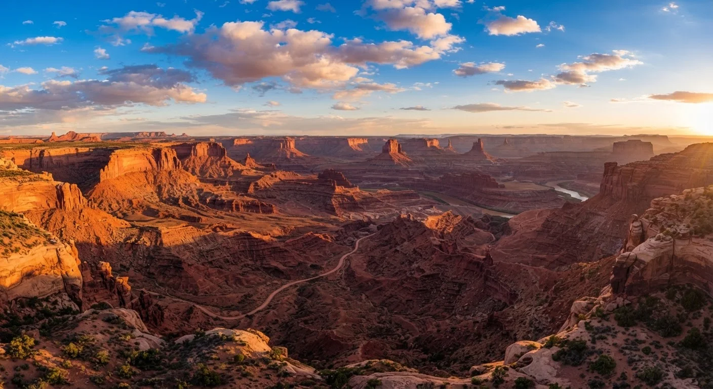
Few regions in the United States reward a road trip as generously as the American Southwest. Within a corridor spanning parts of Arizona, Utah, Nevada, and Colorado, you'll find an almost implausible concentration of dramatic geology — slot canyons, sandstone arches, towering hoodoos, and one of the deepest gorges on Earth — all connected by well-maintained highways and a genuine sense of open road.
The distances are real but manageable. A circuit linking the Grand Canyon, Zion, Bryce Canyon, and Arches National Parks covers roughly 900 to 1,100 miles depending on your starting point and detours. That's a week of comfortable driving, or two weeks if you prefer to linger. Unlike point-to-point trips that require backtracking or one-way rental fees, the Southwest's parks fall naturally into a loop — a logistical gift for road trippers.
If you're still building the foundational skills to structure any long trip well, our guide to building an itinerary that actually works is worth reading before you start penciling in park days.
The Core Parks: What Each One Offers
Understanding what makes each park distinct helps you allocate time wisely rather than giving equal days to unequal experiences.
- Grand Canyon National Park (Arizona): The South Rim is the classic entry point, accessible year-round. Rim Trail walks are accessible to nearly everyone; descending into the canyon requires fitness, planning, and a lot of water. Most visitors who hike into the canyon recommend at least one night at Phantom Ranch — if you can get a reservation.
- Zion National Park (Utah): Famous for The Narrows (a slot canyon waded through the Virgin River) and Angels Landing (a vertiginous ridge hike requiring a permit). Zion Canyon is compact, which is part of why it gets crowded — the park operates a mandatory shuttle system inside the canyon during peak season.
- Bryce Canyon National Park (Utah): Technically not a canyon but an amphitheater of hoodoos — orange and red spires eroded from limestone. It's the highest-elevation park in this group, which keeps temperatures noticeably cooler. The Rim Trail and Queen's Garden loop are crowd favorites.
- Arches National Park (Utah): Home to more than 2,000 natural stone arches, including Delicate Arch — arguably the most photographed feature in Utah. Sunrise and sunset visits to Delicate Arch are magical but require timed-entry reservations.
Beyond these four anchors, consider adding Capitol Reef, Canyonlands, or Monument Valley as day stops or overnight detours depending on your timeline.
Book your Zion timed-entry reservation the moment the reservation window opens — typically at 8 a.m. Mountain Time on a specific release date published by the NPS. Set a calendar reminder and have Recreation.gov open and ready.
Zion is consistently among the most visited national parks in the U.S., and timed-entry slots for peak-season dates routinely sell out within minutes of release.
When planning your Grand Canyon hike, choose your destination based on how much time you have going down — not up. The ascent always takes roughly twice as long as the descent in canyon terrain.
Underestimating the return climb is one of the most common reasons hikers get into trouble at the Grand Canyon, particularly on the steep South Kaibab Trail.
Arrive at Delicate Arch at Arches National Park for sunrise rather than sunset — you'll encounter fewer people and get softer, more diffused light on the arch itself.
Sunset at Delicate Arch draws very large crowds; sunrise visits are substantially quieter and the lighting is often equally dramatic from the opposite angle.
Mapping Your Route and Sequencing the Parks
A practical counterclockwise loop from Las Vegas covers the major parks efficiently: Las Vegas → Zion → Bryce Canyon → Capitol Reef (optional) → Arches/Moab → Canyonlands → Monument Valley (optional) → Grand Canyon South Rim → Las Vegas. Clockwise works equally well; the choice comes down to where you want to start and finish each driving day.
Key highway segments worth knowing: US-89 is the scenic spine connecting much of southern Utah to northern Arizona. Utah's Scenic Byway 12, which links Bryce Canyon to Capitol Reef, is consistently rated among the most spectacular drives in the country — narrow in spots, but worth every mile.
A complete trip-planning framework can help you balance driving days against park time so you're not spending more hours in the car than on the trail.
Plan no more than two to three hours of driving between major stops on days when you also want meaningful time in a park. Driving fatigue in the desert is real, and the scenery between parks is often worth slowing down to appreciate.
Reservations, Permits, and Entry Passes
This is where Southwest road trips most often go sideways for first-timers. The logistics have grown meaningfully more complex in recent years as visitation has surged.
Reservation Windows Fill Up Fast
Timed-entry reservations for parks like Zion and Arches open weeks or months before peak season and frequently sell out within hours. Do not assume you can book a week before your trip. Check each park's official NPS page for exact release dates and set reminders. Showing up without a required reservation may mean turning back at the gate.
America the Beautiful Pass: A single annual interagency pass covers entrance fees at all National Park Service sites for one vehicle. At roughly $80 per year, it pays for itself after two or three park visits and is available at park entrance stations or through the USGS online store.
Timed-Entry Reservations: Zion, Arches, and other high-demand parks have implemented timed-entry reservation systems during peak periods. These sell out weeks or months in advance on Recreation.gov. Check each park's official NPS page for the current year's requirements — policies change seasonally.
Permits: Angels Landing at Zion and The Wave at Vermilion Cliffs require separate permits via lottery. Phantom Ranch overnight reservations at the Grand Canyon are booked via lottery 15 months in advance. If these are priorities, plan your entire trip timeline around permit availability first.
If you're coordinating this trip with a group, strategies for group travel planning can help you navigate the reservation process without the headaches that come from misaligned expectations.
Timing, Weather, and Crowds
The Southwest is a year-round destination, but each season carries distinct trade-offs.
- Spring (April–May): Widely considered the sweet spot. Temperatures are moderate at most elevations, wildflowers appear along canyon floors, and crowds — while growing — haven't hit summer peaks. Late spring can bring afternoon thunderstorms in the canyon country.
- Summer (June–August): Busiest season and hottest temperatures. The Grand Canyon's inner canyon regularly exceeds 110°F. Hiking before 10 a.m. is strongly advised. The higher-elevation parks (Bryce, Cedar Breaks) are more tolerable but still packed.
- Fall (September–October): Crowds thin after Labor Day, temperatures ease, and canyon light turns golden. Monsoon moisture from summer typically fades by mid-September. Many experienced Southwest travelers consider October the best month in the region.
- Winter (November–March): The Grand Canyon's South Rim stays open year-round and sees far fewer visitors in winter — snow-dusted canyon walls are genuinely stunning. Zion and Bryce are also open but some facilities close; Bryce's hoodoos with a snow cap are a photographer's dream.
6M+
Annual visitors to Zion National Park
According to NPS annual visitation statistics, Zion regularly attracts over six million visitors per year, making it one of the busiest national parks in the country.
277 miles
Length of the Grand Canyon
The Grand Canyon stretches 277 river miles along the Colorado River, with depths reaching over a mile — making it one of the most dramatic geological features on Earth.
2,000+
Natural arches in Arches National Park
Arches National Park contains the highest density of natural stone arches in the world, according to the National Park Service.
Packing and Safety Essentials
Desert environments are beautiful and unforgiving in equal measure. The risks — dehydration, heat illness, flash floods, and sudden temperature drops at elevation — are real but entirely manageable with preparation.
Water: The standard advice is to carry at least one liter of water per hour of hiking. In summer heat or strenuous canyon descents, that minimum should be higher. Many trailheads have water stations; verify before heading out. Never rely on finding water on the trail unless you're carrying a filter and have confirmed sources.
Sun protection: High desert altitude intensifies UV exposure. Broad-spectrum sunscreen, a wide-brim hat, and sun-protective clothing are practical necessities, not optional extras.
Footwear: The Narrows at Zion requires water-appropriate footwear — many visitors rent canyoneering shoes and neoprene socks near the trailhead. For dry trails, sturdy hiking boots with ankle support are strongly preferred over trail runners on rocky terrain.
Emergency preparedness: Cell service is unreliable across much of the Southwest backcountry. Download offline maps before leaving a cell coverage area. A personal locator beacon (PLB) is worth considering for any off-trail or remote hiking.
For those doing this trip solo, our grounded introduction to solo travel offers useful safety mindset and planning tips that apply directly to remote desert environments.
Park conditions, entry requirements, reservation policies, and permit systems change regularly. Always verify current rules directly with the National Park Service (nps.gov) and check official government travel advisories before your trip. This article is for general informational purposes only.